

INTRODUCTION
The LIGHT Lechmere International Ideas Competition invites artful and creative responses from the best emerging and established professionals from across the region, the nation, the world.
These ideas will offer a variety of visions for how one might:
Illuminate the Lechmere Viaduct in an extraordinary way.
Improve the public realm along the river banks, promote access and encourage activity along and across the Charles River
Use light as means to inspire and educate about history and innovation, past, present, future
….which together, are meant to stimulate lively conversations and catalyze new vision about the future of this crossing, and help decision makers, stakeholders, and the public imagine how an illuminated viaduct might strengthen ties between the communities it connects, and raise civic consciousness about the benefits of superior illumination.
THE OPPORTUNITY 

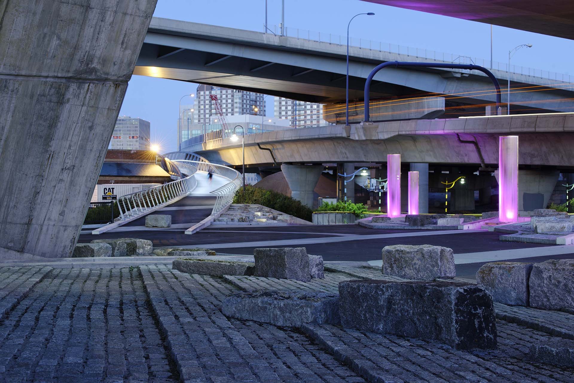
The Lechmere Viaduct (bridge) presents an extraordinary opportunity for creative, artistic illumination. Situated between two neighborhoods currently undergoing great revitalization, illumination will celebrate the area’s continuing growth and visible energy as it enhances the public realm of the Charles River.
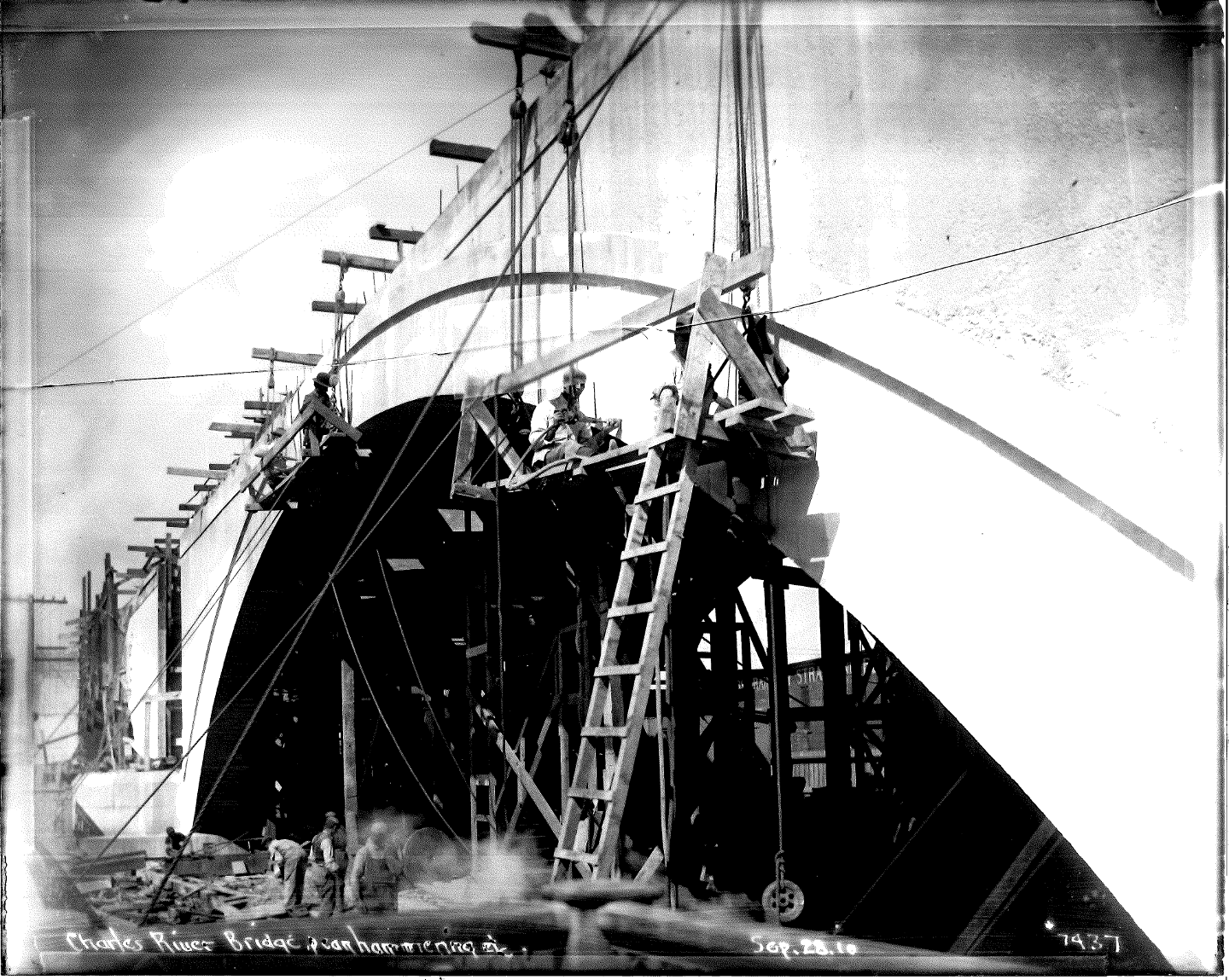
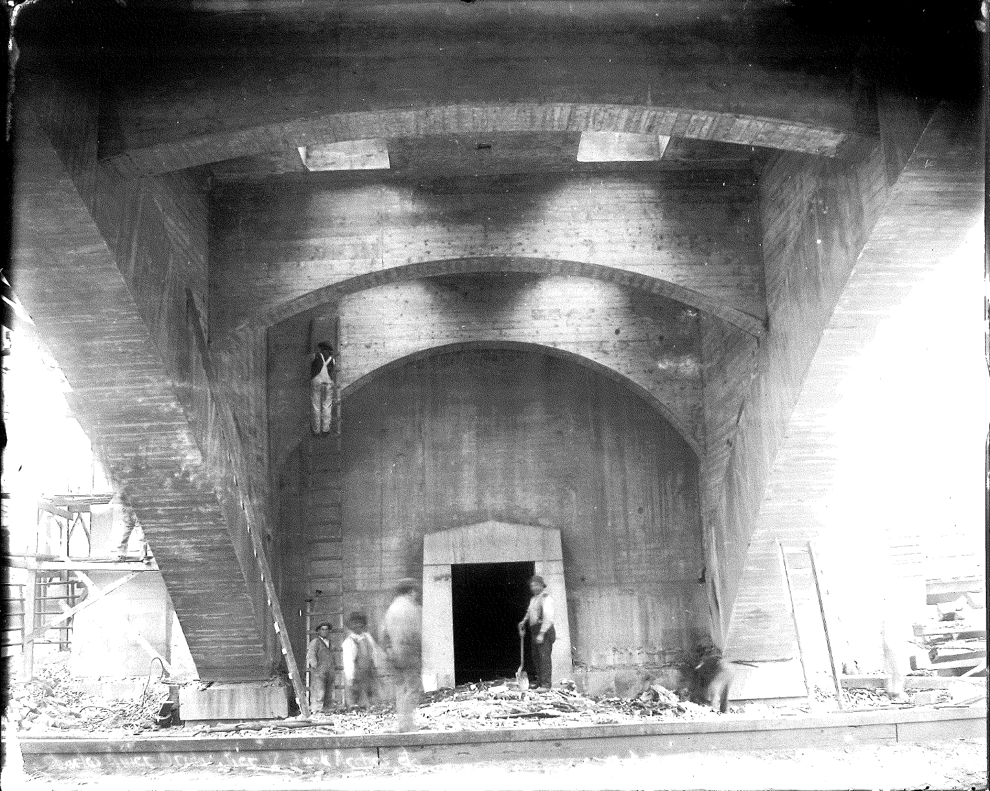
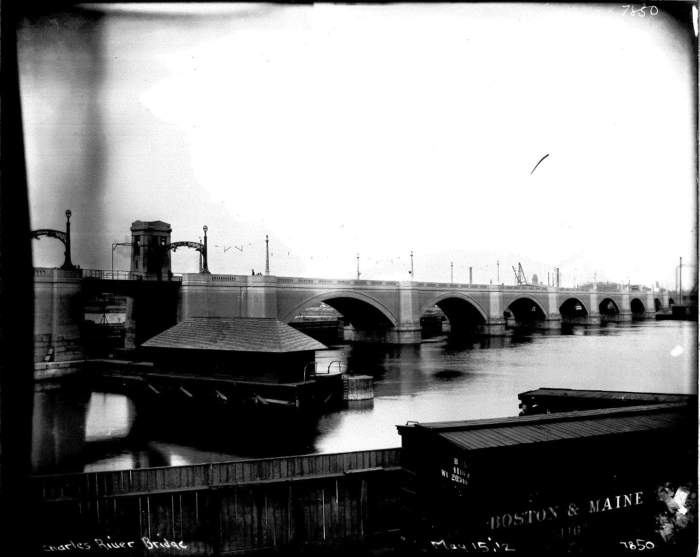
Built in 1910, the Lechmere Viaduct is approximately 1,700’ long by 35’ wide — a series of eleven reinforced concrete arches and one steel bridge with masonry abutments. It carries the MBTA Green Line trains over the Charles River from Science Park station in Boston to Lechmere station and terminus in Cambridge. It was originally built to connect multiple streetcar lines in Cambridge and Somerville to Downtown Boston. At the time, it was the largest public works project in the region.
The Lechmere Viaduct merits being masterfully illuminated and celebrated! From the recent Zakim Bridge to the restored historic bridges near the Harvard campus, this is the last crossing of the famous lower Charles River yet to be given a strong nighttime identity. Illumination of the most massive crossing of them all will also celebrate the extension of the MBTA’s (Massachusetts Bay Transportation Authority) Green Line service north of its current Lechmere terminus, which will connect the cities of Boston, Cambridge, Somerville, and beyond. Substantial recent investment along the banks of the Charles has created new parks, paths, and public spaces on both sides of the river, as new buildings have brought new businesses and residents to the adjacent neighborhoods too. How can an illuminated viaduct support, stimulate, and celebrate this new activity?
For more on the history of the site, as well as recent improvements in this area, see the CONTEXT information in the Appendix.
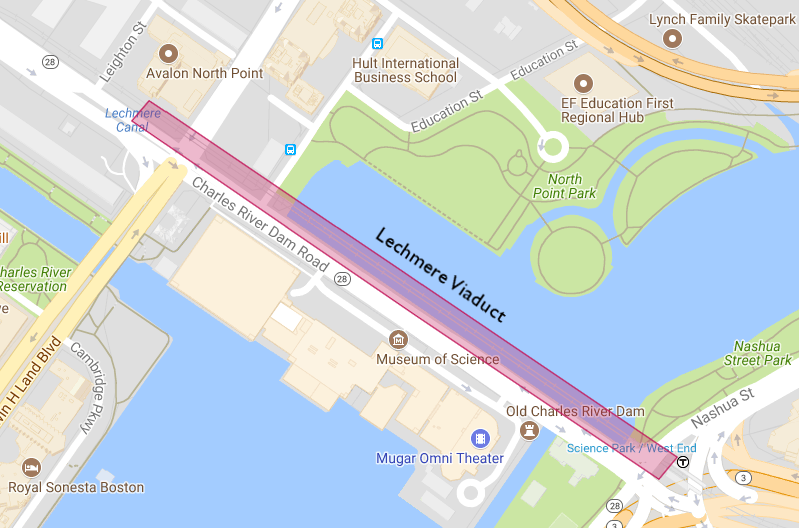 Click to view Google Maps
ELIGIBILITY
This is an open, international, single stage ideas competition. Entries are welcome from anywhere in the world. Artists, lighting design professionals, landscape architects and architects, engineers, students, and others are invited and encouraged to participate. Interdisciplinary teams are encouraged.
The jury will be conducted as a blind review; winners will be selected anonymously.
PRIZES
The jury will award First Prize ($7,500USD), Second Prize ($5,000USD), and Third Prize ($2,500USD). The jury will also recognize Honorable Mention, at their discretion.
All submissions will be included in an online gallery, with the possibility of a local exhibition.
CRITERIA + DESIGN CONSIDERATIONS
LIGHT BOSTON SEEKS DESIGNS THAT:
create dynamic, site-specific illumination to emphasize the unique architectural and engineering features of the bridge. Please note these features:
- all eleven arched bays and the steel bridge over the old lock, and the movement of trains on the top deck
- the six bays and bridge over water, capitalizing on their reflective aspects. Complete the gesture of connection from end to end and shore to shore
- recognize that at the western end, bay #10 spans Museum Way and the new access road to the new Education First campus
create a unique community asset that complements the developing neighborhood to the west, features the lagoon and North Point Park, and adds both safety and drama to the northern sidewalk along Msgr. McGrath Highway;
be engaging during all seasons, and be respectful of neighboring buildings, their inhabitants, and as promulgated in LEED criteria;
consider affordability and sustainability in both initial investment and day-to-day operating cost, as well as long-term maintenance (life cycle cost);
CONSIDER….
DESIGN AESTHETICS – How well does the design concept invigorate and make more understandable the architecture of the Lechmere Viaduct and its surroundings? Is it visually striking? Does it support the needs of stakeholders (MBTA, pedestrians/commuters, abutters, boaters, etc.).
DYNAMIC FLEXIBILITY & COMMUNITY – Boston and Cambridge have a long heritage and many events throughout the year that are held to celebrate different occasions. How well does the proposed design accommodate both more subdued daily life, and provide opportunities to be a part of public and private events held in the area? the area around the Viaduct is rich with public spaces that are frequented by increasing numbers of residents, visitors, and corporations with continual traffic by foot, bicycle, train, and watercraft. Does the design proposal offer enhancements that appeal to multiple audiences?
SUSTAINABILITY & RESILIENCY- does the design respect the environment? Will it endure the test of time in a beautiful way?
INSTALLATION & OPERATION – how easy is the design to install, operate and maintain?
BUDGET – can this be built cost-efficiently? For planning purposes and in order to assist with design decisions, a ballpark budget should be thought of as $700,000 USD for the illumination package (including light fixtures, control devices, and power connection) and for installation (including labor and related costs). This budget does not include design or administrative fees.
JURY
The jury will be comprised of internationally renown artists, design professionals, and civic and community leaders and will include:


ORGANIZERS
This design competition is organized and administered by LIGHTBoston. LIGHT Boston is a 501(c)3 non-profit corporation founded in 1996. Please visit www.lightboston.org for more information.
Competition partners include a growing list of public, private, and nonprofit organizations all interested in improving the public realm connection between Boston and Cambridge, activating the banks of the Charles River, and celebrating the past, present, and future of innovation and history through illumination.
Invited advisors to the competition include representatives from the MBTA, the City of Boston, the City of Cambridge, the Charles River Conservancy, the Boston Society of Landscape Architects, the Boston Society of Architects, the Boston Preservation Alliance, the Illumination Engineering Society, and the Designers Lighting Forum, along with community stakeholders and civic leaders.
SPONSORS
LIGHT Boston thanks the generosity of these sponsors and community partners for their support:


SCHEDULE
| Competition opens: | September 2019 |
| Registration deadline: | 21 December 2019 |
| Questions accepted until: | 28 December 2019 |
| Submission deadline: | 24 January 2020 |
| Winners announced: | February 2020 |
REGISTRATION
Click here to register. When you register, you will be prompted to submit the entry fee.
| Entry Fee: | $75 USD for professionals |
| $25 USD for students |
Registered competitors will receive a Confirmation of Eligibility and an individual Competitor ID number.
To keep entries anonymous, all submission documents must be identified only with the randomly-generated, 3-digit Competitor ID number. Submissions that include competitors name or identifying information on the face of the boards will be disqualified.
Multiple submissions are permitted. Each submission must be entered as a separate effort, including an additional registration form, fee, and unique ID number.
SUBMISSION REQUIREMENTS
Entries are to be submitted electronically, may include videos, and should be concise, readily understood by a lay public, and lend themselves to both website and print exhibition.
Each entry is required to submit electronically one board (PDF). Entrants are permitted to also submit one video (video is optional). The “board” is to be formatted to 30” high x 40” wide horizontal/landscape orientation. The board must be submitted as PDF and JPG file formats (300 DPI resolution); total file size of the board not to exceed 25 MB. Videos do not need to meet that file size.
Submissions should include (but are not limited to) the following images:
- Sections, plans, elevations, and/or site plan that explain key components of the design;
- Illustrative representations that illustrate the design – perspectives, montages, and/or sketches that celebrate the character of the lighting solution;
- A typical lighting bay(s) or other detail; and
- A project narrative (max 300 words).
The digital layout of each board must include a 1” x 1” square in the top right-hand corner with the Competitor’s ID number at 36 pt. font size contrasting with the background
This is a “blind” competition. Boards must NOT include any information (name, organization, school, etc.) that may reveal the identity of the competitor.
All text must be in English with a maximum of 300 words for project explanation with readable font sizes for the 30”x40” board, and scale-able for website upload
Short video clips (not exceeding total 30 seconds) showing moving light elements or fly-throughs of the submission may be included in the presentation.
ANNOUNCEMENT, ONLINE GALLERY, EXHIBITION
There will be a public announcement of the finalists, with an event to take place in Boston and broadcast online via Facebook live or similar.
There will also be an online gallery of all submissions. Competition results will be widely distributed via web.
There may be a local (Boston/Cambridge) exhibition of up to 20 submissions.
COPYRIGHT
Competitors retain copyright of their own submissions; any use by others is prohibited without written permission from the competitor, with the exception of that listed here: With attribution of authorship, LIGHT Boston, Inc. and LIGHT Lechmere competition organizers, sponsors, and those they designate may use the subissions for announcing, celebrating, and publicizing the competiiton results, and for promoting discussion about the future of the site, including publication in print and online.
Next Steps
Questions regarding LIGHT Boston, the LIGHT Lechmere competition, competition requirements or related matters may be submitted via email to LIGHTLechmere@gmail.com by 21 December 2019. Answers will be posted on a rolling basis.
We hope that you are as excited about this extraordinary opportunity as we at LIGHT Boston are. The illumination of this iconic structure, shared by the world-class cities of Boston and Cambridge, presents a unique chance both to respect the historic significance of the Lechmere Viaduct and to demonstrate the cutting edge innovation culture that characterizes the region. Your creative concepts could become the visual representation that identifies this neighborhood and generates excitement for the area well into the future.
APPENDIX
CONTEXT
A. History
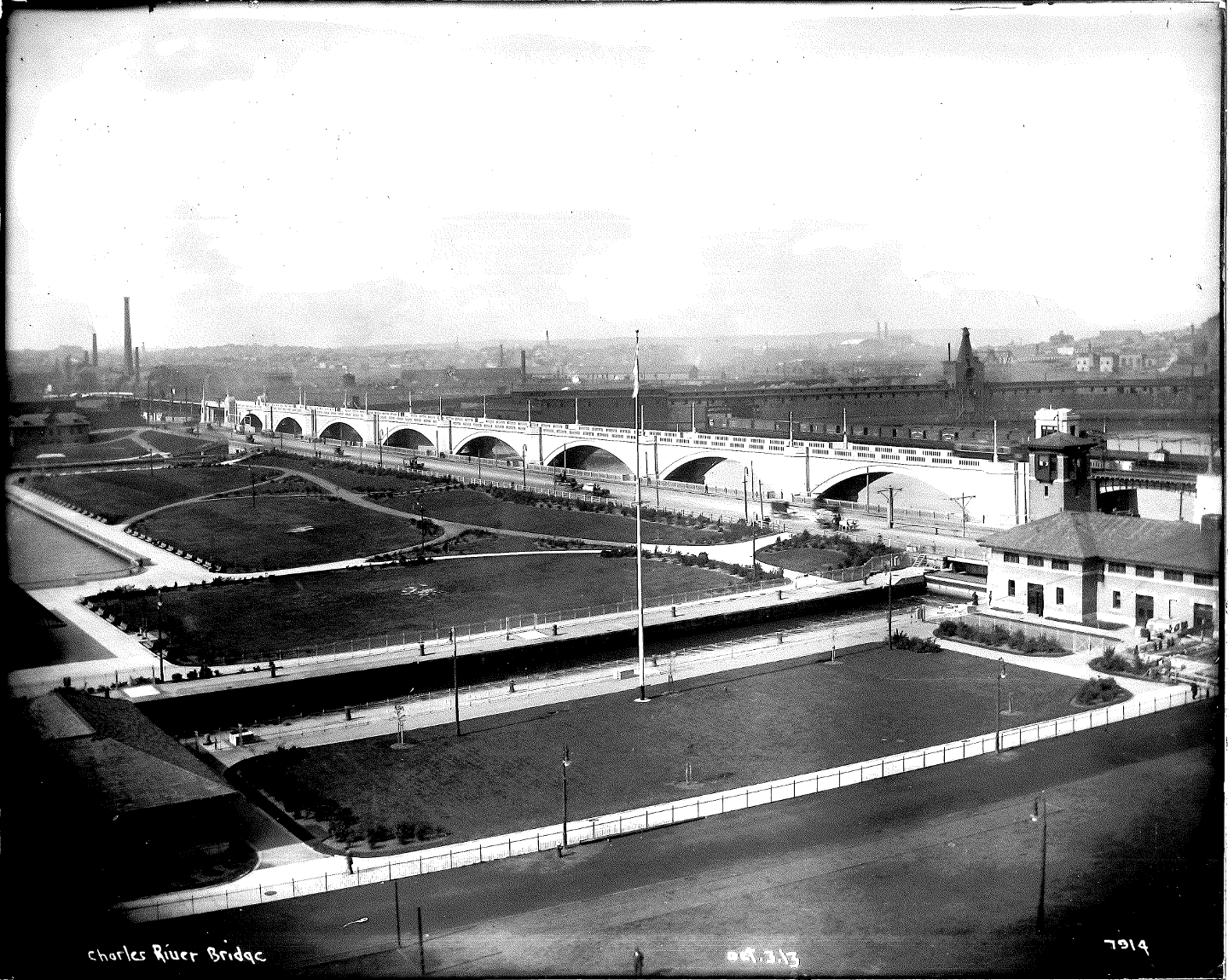
The banks of both sides of the Charles River between the Museum of Science and Boston Harbor were once heavily industrialized with a landscape of rail yards, polluted drainage ditches, and wharf warehouses, with limited and undesirable pedestrian access to the river.
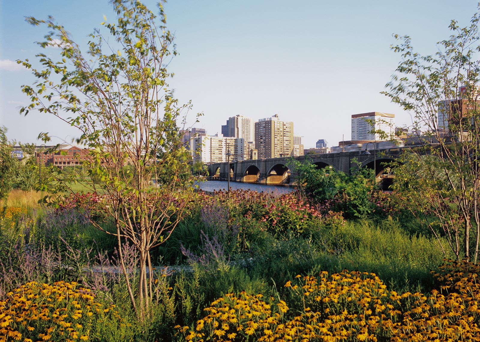
The historic lock and Boston’s Museum of Science, built in 1949 on top of the first Charles River dam, are immediately to the south of the Viaduct. A dam farther downstream, built and operational in 1978, stabilized the water level of the Charles River on both sides of the Lechmere Viaduct. To the west, the Cambridge side, dubbed the “Lost Half Mile” by the Massachusetts Department of Conservation and Recreation (DCR) benefited from the 2003 construction of the Central Artery’s Leonard P. Zakim Bridge. With its ramps high above the river, the Zakim Bridge brought an opportunity on the Cambridge side for a lagoon and new riverfront, with 40 acres of new landscaped parkland — North Point Park, a skate park, two residential towers, dramatic headquarters buildings, and major new additional high-rise development surrounding Lechmere station and into the area bordering on MIT. Similar public realm improvements are planned for the Boston side of the river.
Creation of the North Point Park area and surrounding neighborhood development has generated additional revitalization projects. Today, the area is crossed by bike paths, pedestrian walkways, and boat traffic between the Charles River and Boston Harbor. Public rail transit improvements, already begun, will continue to make access to the area even more convenient for new residential, retail, community, and commercial uses, adding to the increasing vibrancy of the growing neighborhood.
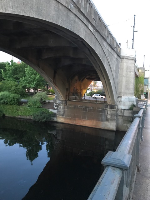
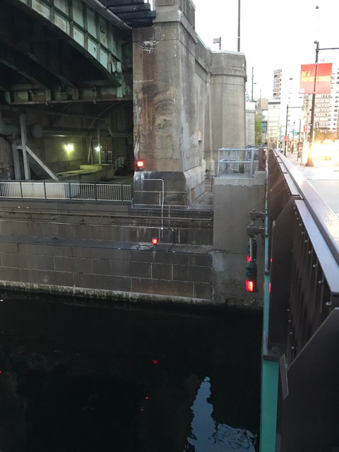
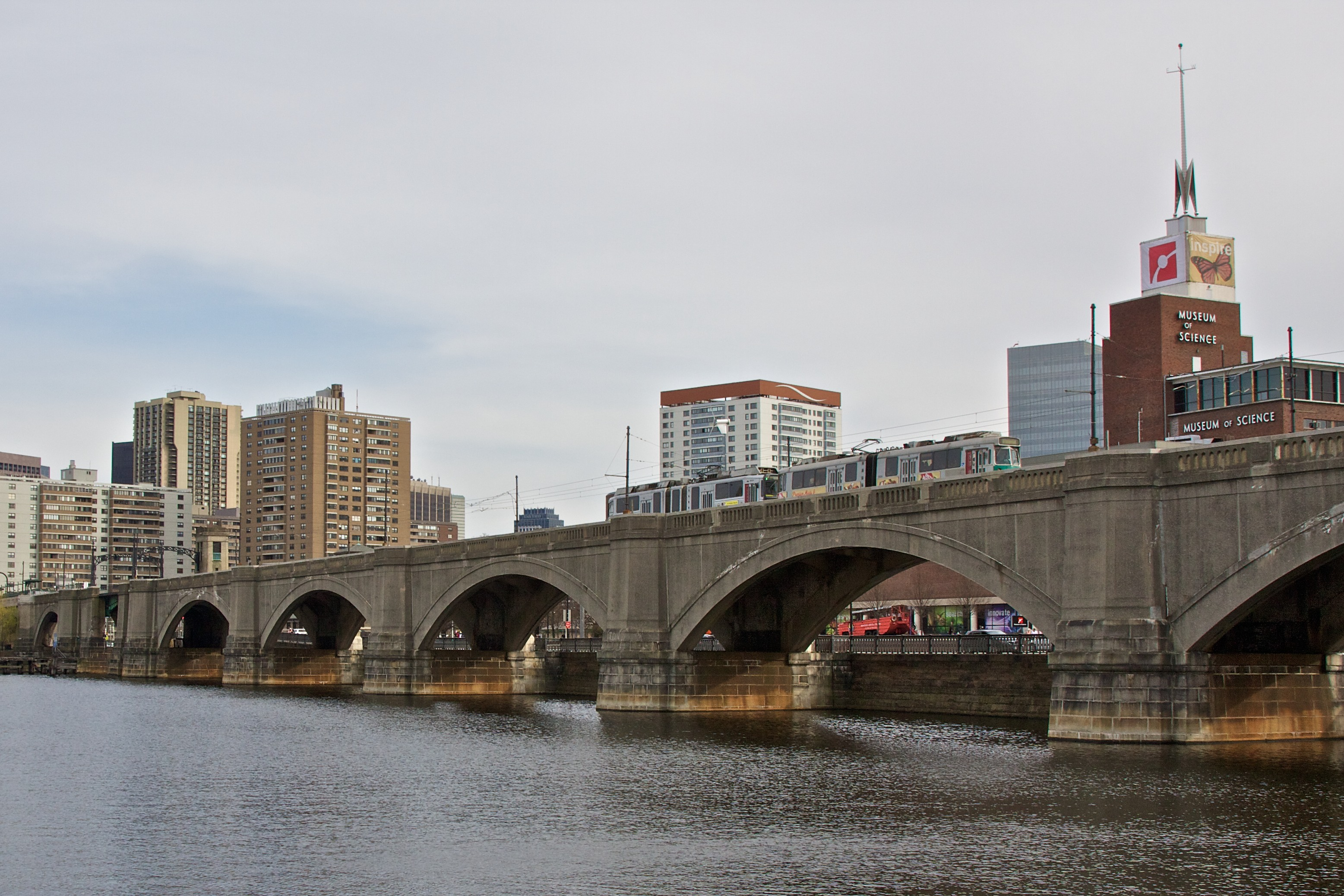
Photo (right): Present day bridge over old locks; note steel girder support
B. Recent Improvements
Many recent initiatives are working to improve the public realm of this area. Providing beautiful, safe, and continuous pedestrian access along the Charles River throughout the day and seasons is a priority of the new park system. An artfully illuminated Lechmere Viaduct is a critical missing link in this new system.
This 2012 blog post by landscape architect, writer, and independent researcher Patrice Todisco provides a good summary of recent and planned improvements in the lower Charles River basin: https://landscapenotes.com/2012/07/08/new-charles-river-basin-parks-north-point-nashua-street-paul-revere/
Following are more details on some of those projects, as well as new projects initiated in more recent years:
North Point Park
Landscape Architect: Oehme, van Sweden | OvS
Completed 2007
More info: https://www.ovsla.com/portfolio-items/north-point-park-ma/
“This eight-and-a-half-acre park, located atop a brownfield in Cambridge, is oriented along broad waterfront edges in the midst of the city. The park focuses attention on the Charles River Basin and away from the bustle of nearby city highways. Terraced seating areas and sloping lawns enhance the connection to the river. While the overall landscape character of the park is intended as a simple, bold statement, the landscape accommodates a variety of passive and active recreational activities.”
“Planting is arranged in the traditional park manner, but enhanced with broad, meadow-like masses that provide accent and create interest. Bold sweeps of perennials provide year-round beauty. Shade trees placed along the park’s edges form a continuous green boundary, and flowering trees frame dramatic river views.”
Nashua Street Park
Landscape Architect: Halvorson Design
Completed 2005
More info: http://www.halvorsondesign.com/nashua-street-park
“Nashua Street Park engages the public with access to the Charles River shoreline and linkages to adjacent areas for walkers, bicyclists and rollerbladers through a network of paved paths.
The park design includes carefully integrated moments of artistic expression. A spiral granite scupture forms an axis at the heart of the open plaza and provides access to elevated views of the river.
The provision of full accessibility was critical to the design of the site, allowing use by all members of the community and serving as an informal therapeutic resource for the nearby Spaulding Rehabilitation Hospital.”
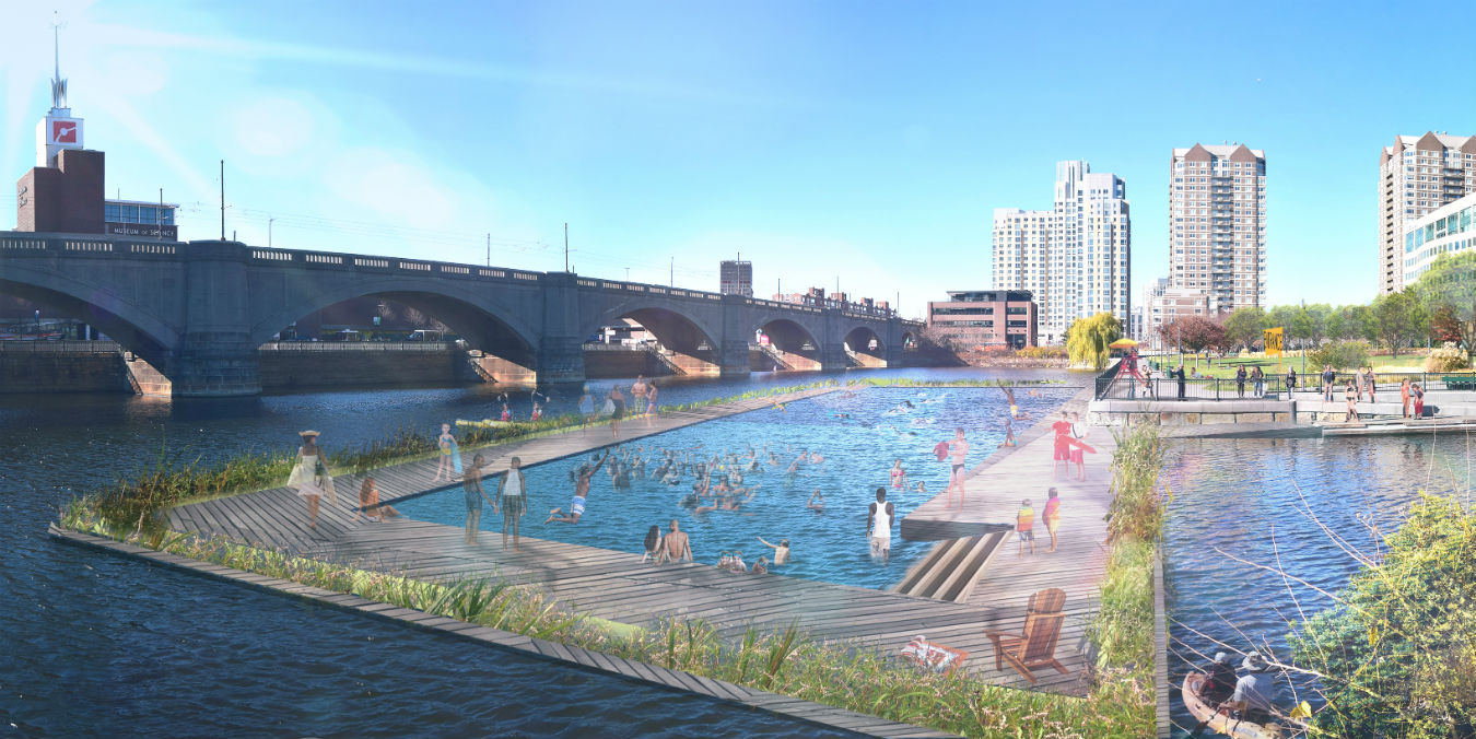
Swim the Charles
Led by the Charles River Conservancy; Landscape Architect: Stantec
In planning; not completed
The Charles River Conservancy is working “to build a safe, fun, and accessible seasonal swimming facility in the Charles River to be enjoyed by everyone,” next to the Lechmere Viaduct. Feasibility studies and concept design has been completed. See images and read more here: http://www.thecharles.org/swim-park-project/
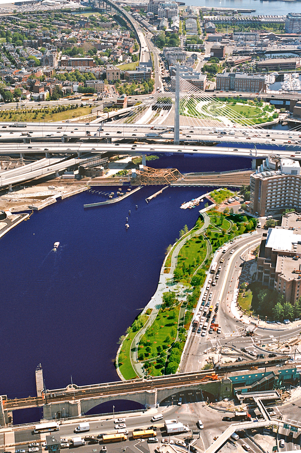
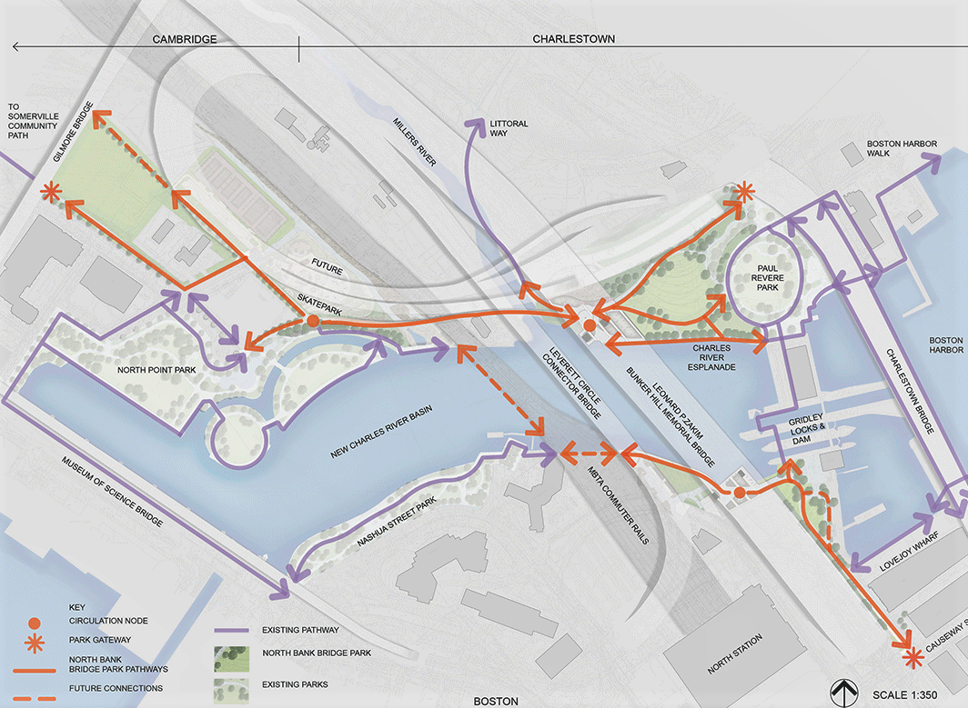
North Bank Bridge Park
Landscape Architect: CRJA | IBI Group
Opened to pedestrian use: 2012
More info:https://crja.com/project/northbank-bridge-park/
“The North Bank Bridge and its associated park component is the final park project in the NCR Basin…The 11-acre park contains waterfront esplanades, passive open space, and special treatment to animate the underbridge pedestrian environment on both the Boston and Cambridge sides of the river. The planning process included siting a maintenance facility and accommodating such active recreation facilities as multi-use trails, soccer fields, tennis courts and a skateboard park, much of which will be added in future phases.”
“The centerpiece of this project is a multi-use bridge which features dramatic curvilinear or ‘sinusoidal’ structure that provides a counterpoint to the adjacent angular geometry of the Leonard P. Zakim Bunker Hill Bridge. The North Bank Bridge, which provides pedestrian access across the commuter rail tracks leading into nearby North Station, finally executes Charles Eliot’s century-old vision of connecting the parks along the Charles River with those of the Boston Harbor.”
These site plan diagrams by CRJA | IBI Group show the new park system in the new lower Charles River basin. Please note that the Lechmere Viaduct runs along the Museum of Science Bridge, forming the western edge of the new Charles River Basin.
TECHNICAL PACKAGE
This is an ideas competition. That said, the intent is to stimulate dialogue and catalyze opportunity for the implementation of an extraordinary lighting scheme. Schemes that propose strategies that accomodate the physical realities of the viaduct will be appreciated.
A. Electronic Model
A diagrammatic 3D model is provided for your use. Click here to download. The model is for illustrative purposes only. LIGHT Boston accepts its approximate dimensions for the purposes of this competition.
The model has been generously provided by EC Existing Conditions, Boston, MA.
B. Elevation Diagram
This sketch of the North Side elevation of the Lechmere Viaduct furnishes the key to designations of Spans (arches and bridge) and Piers (abutments) cited in the working drawings from 1910.
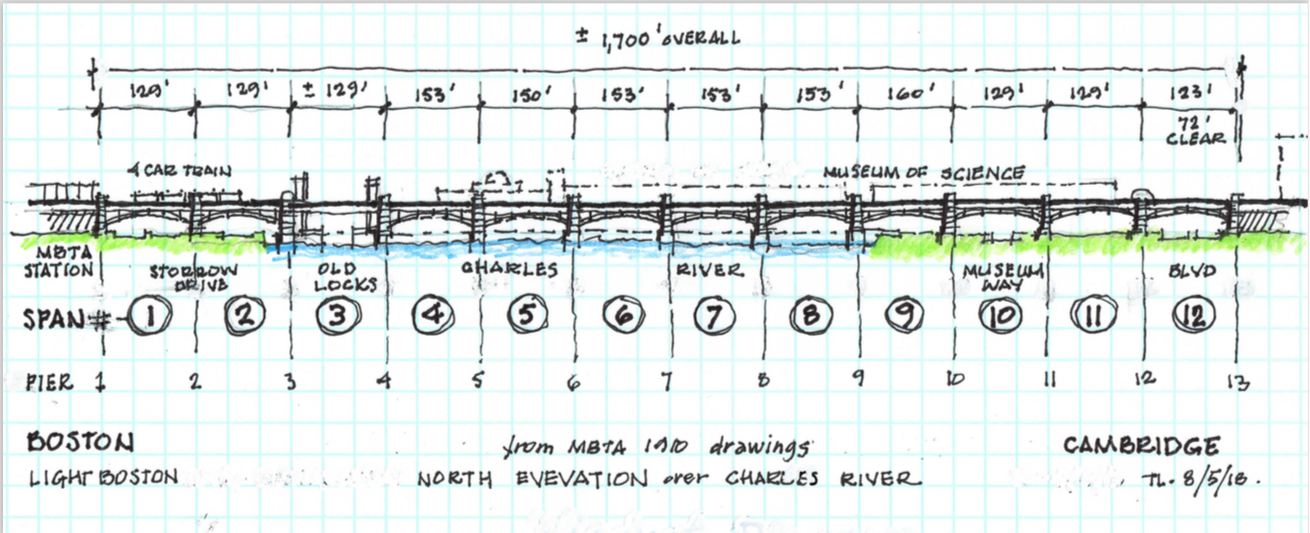
The sketch is useful to understanding the working drawing nomenclature. The 1910 drawing package (12 sheets), does not include either full elevations or an overall plan of the Viaduct, or details of the fixed-span steel bridge. Hence, the separate parts of the original drawings, organized into group-like elements, are not easy to understand as a complete assemblage, until referenced back to the diagram.
C. Working Drawings
The twelve-sheet set of the historic 1910 drawings from the MBTA archives are available from the following link: https://viaduct.lightboston.org/wp-content/uploads/2018/08/ECE-Lechmere-Viaduct.pdf.